
File:Congo Democratic Republic Map.jpg
Size of this preview: 433 × 479 pixels.
| |
This is a file from the Wikimedia Commons. Information from its description page there is shown below.
Commons is a freely licensed media file repository. You can help. |
| Description |
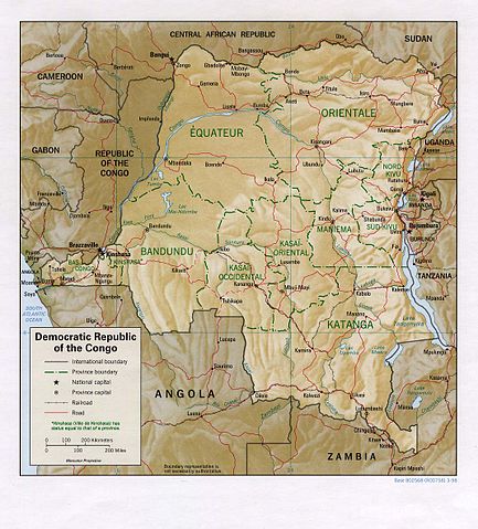
English: Shaded relief map of the Democratic Republic of the Congo (the former Zaire).
|
|||
| Date | 1998 | |||
| Source | from the Perry-Castañeda Library Map Collection. | |||
| Author | CIA | |||
| Permission ( Reusing this file) |
|


File usage
The following pages on Schools Wikipedia link to this image (list may be incomplete):
What is Schools Wikipedia?
Schools Wikipedia was created by children's charity SOS Childrens Villages. Thanks to SOS Children's Villages, 62,000 children are enjoying a happy childhood, with a healthy, prosperous future ahead of them. Help another child by taking out a sponsorship